How Climate Change Intensified Helene and the Appalachian Floods
Helene is the fourth Gulf Coast hurricane to make landfall this year. Only five other years had that many since comprehensive hurricane records began in 1851.
The last time was 2020.
Locating the center of a hurricane is essential to forecast storm surge flooding, but it is also critical to remember that impacts from the storm go far beyond the coast, extend well outside of the forecast cone and are not symmetric to the center of the storm.
Recognizing ground conditions before the storm arrives is also vital to understanding what comes next. Long before Helene was anywhere near the southern Appalachians, rain was already falling there, but it had nothing to do with the hurricane.

Explore the latest news about what’s at stake for the climate during this election season.
Hundreds of miles north of the Gulf Coast, the winds that steer weather systems converged slowly, leaving an old stationary front to focus heavy rain Wednesday and Thursday in the southern Appalachians.
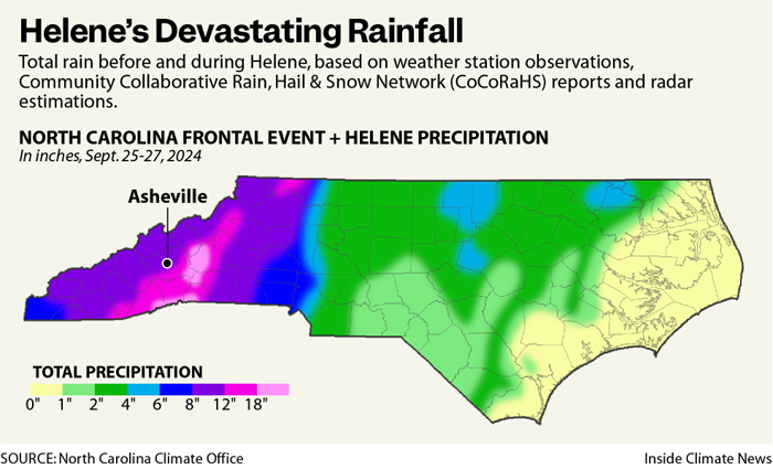
Water levels initially rose slowly Wednesday evening, and the French Broad River on the west side of Asheville, North Carolina crept above flood stage just after daybreak Thursday morning. By midnight Thursday, more than four inches of rain had fallen on Asheville.
Once Helene arrived early Friday morning, the rain intensified, and flood waters rose 10 additional feet over the next nine hours, unleashing the catastrophe.
Knowing the center of a hurricane helps determine wind direction as the storm nears. In this case, it approached from the south and turned northwest. This meant a strong wind from the southeast pushed additional moisture up the eastern side of the Appalachians. As humid air rises, its water vapor cools and condenses to form clouds and rain. Effectively, the upslope winds intensified the rain rates—and the rain totals.
Two Systems Converge
There is no modern analogy to this flood for western North Carolina. The French Broad River crested at 24.67 feet on Friday evening, its highest level since records began in 1895, and exceeding the previous record of 23.1 feet, when two tropical systems hit within one week in July 1916.
On the south side of Asheville, the Swannanoa River crested at 26.1 feet on Friday afternoon, more than five feet above its previous record during that same period in 1916. The only comparable crest is from early Tennessee Valley Authority records, suggesting a 26-foot crest in 1791.
Like 1916, it took two systems to come together within a few days to produce catastrophic floods. There were signs it would be comparable to the 1916 flood, and an unusually dire statement was released from the local National Weather Service office on Thursday afternoon, but it is difficult to know how many people got the message or fully understood how to respond.
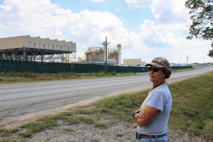
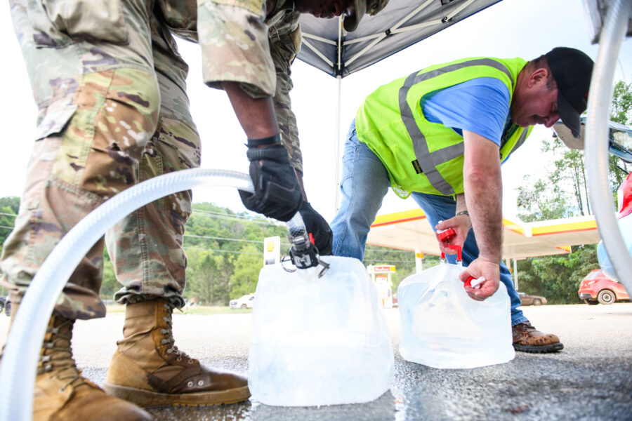
Asheville is one of the locations that houses the nation’s archived weather and climate data—the NOAA National Centers for Environmental Information, or NCEI. According to NOAA on Tuesday afternoon, the people who work at the Asheville office confirmed that all of their colleagues and staff were accounted for, but many of them remained without water or electricity.
The building in downtown Asheville now has electricity, but no water. Additionally, their network service provider remained down; there is no timeline indicating when remote access of their data would resume.
Climate’s Impact: Rainfall Intensity and Hurricane Strength
The influence of climate change on this storm is twofold and intertwined. One is rainfall intensity and the other is hurricane strength. The broad connections are straightforward, but getting a precise figure on the attribution is complex.
Warmer air can evaporate more water into the atmosphere, thus sending more water back to the ground in the form of more intense precipitation.
The relationship is not linear, as potential evaporation increases about 4 percent for every 1 degree Fahrenheit. That precipitation signal has already been detected: according to the Fifth National Climate Assessment, the amount of rain in the most intense rainstorms has increased 37 percent in the Southeast since 1958.
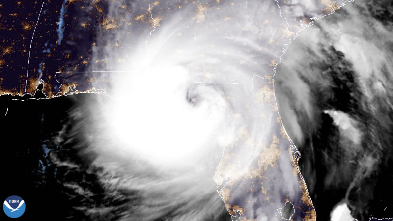
More specifically to Helene, the water along its path in the Gulf of Mexico was significantly warmer than normal.
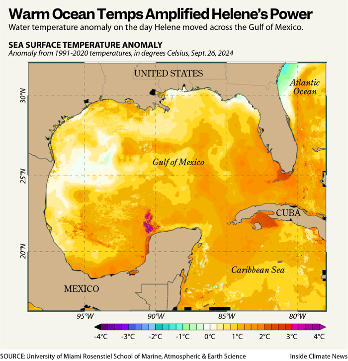
Water in the Gulf of Mexico is historically very warm in late September, with temperatures typically in the middle 80s. But along Helene’s path, the water was about 2-3 degrees Fahrenheit above average. In a part of the world where the water temperature variation is not especially high, that difference is dozens, if not hundreds, of times more likely because of the warming climate.
The winds in the upper atmosphere were already conducive to strengthening the hurricane, but the warmer water helped the storm strengthen more quickly. In meteorology, the term “rapid intensification” is specific, meaning the strongest sustained winds must increase by at least 35 miles per hour in 24 hours. Helene easily reached that threshold on its final day before landfall, with 85 mph winds at 8 p.m. Wednesday and 140 mph winds 24 hours later.
Not surprisingly, there is building evidence that rapid intensification is happening more often because of the warming climate.
Heavier Rains
A preliminary analysis from Lawrence Berkeley National Lab suggested rain totals in the western Carolinas were about 10 percent heavier due to the warmer climate and 50 percent heavier in western Georgia and central North Carolina. This will be the first of numerous analyses reviewing the storm to determine the climate change role.
Friederike Otto is a climate scientist in the U.K. and one of the founders of the World Weather Attribution project, pioneering climate change attribution studies since 2014. Over the last few years, the capability to do such rapid analyses has grown as computing power and access to climate data have both improved.
WWA is currently working on an independent analysis of Hurricane Helene with results expected in early October.
“We will combine different methods and models, increasing confidence in the result,” Otto said. “In the U.S., we have good observations and good climate models, so their [Lawrence Berkeley] numbers are probably pretty close to what we will find in our study.”
Is Milton Next?
The hurricane season is far from over, as two storms spin in the eastern Atlantic. Neither pose a threat to the United States, but there is concern about a new storm possibly taking shape in the Gulf of Mexico during the first weekend of October, potentially named Milton.
Although tropical development tends to wane quickly after the middle of October, the season continues until the end of November. As 2020 showed us, it is still too early in the season to dismiss the idea of more tropical systems impacting the United States.
Sean Sublette is a multimedia meteorologist who holds the American Meteorological Society’s Certified Digital Meteorologist designation. He previously worked as a broadcast meteorologist for 19 years in the Roanoke-Lynchburg area of Virginia and for six years with scientists at Climate Central in Princeton, New Jersey.
About This Story
Perhaps you noticed: This story, like all the news we publish, is free to read. That’s because Inside Climate News is a 501c3 nonprofit organization. We do not charge a subscription fee, lock our news behind a paywall, or clutter our website with ads. We make our news on climate and the environment freely available to you and anyone who wants it.
That’s not all. We also share our news for free with scores of other media organizations around the country. Many of them can’t afford to do environmental journalism of their own. We’ve built bureaus from coast to coast to report local stories, collaborate with local newsrooms and co-publish articles so that this vital work is shared as widely as possible.
Two of us launched ICN in 2007. Six years later we earned a Pulitzer Prize for National Reporting, and now we run the oldest and largest dedicated climate newsroom in the nation. We tell the story in all its complexity. We hold polluters accountable. We expose environmental injustice. We debunk misinformation. We scrutinize solutions and inspire action.
Donations from readers like you fund every aspect of what we do. If you don’t already, will you support our ongoing work, our reporting on the biggest crisis facing our planet, and help us reach even more readers in more places?
Please take a moment to make a tax-deductible donation. Every one of them makes a difference.
Thank you,
David Sassoon
Founder and Publisher
Vernon Loeb
Executive Editor
Share this article
- Republish
Disclaimer: The copyright of this article belongs to the original author. Reposting this article is solely for the purpose of information dissemination and does not constitute any investment advice. If there is any infringement, please contact us immediately. We will make corrections or deletions as necessary. Thank you.